The Mud-Brick Chronology: What C-14 Dates at Rakhigarhi Reveal About Early Harappan Urbanization
Radiocarbon recalibrations and stratigraphic sections at Rakhigarhi’s lowest levels expose the slow, local assembly of Early Harappan mud-brick architecture in the Ghaggar-Hakra basin.

Rohan Bhattacharya for SwavedaOctober 26, 2026
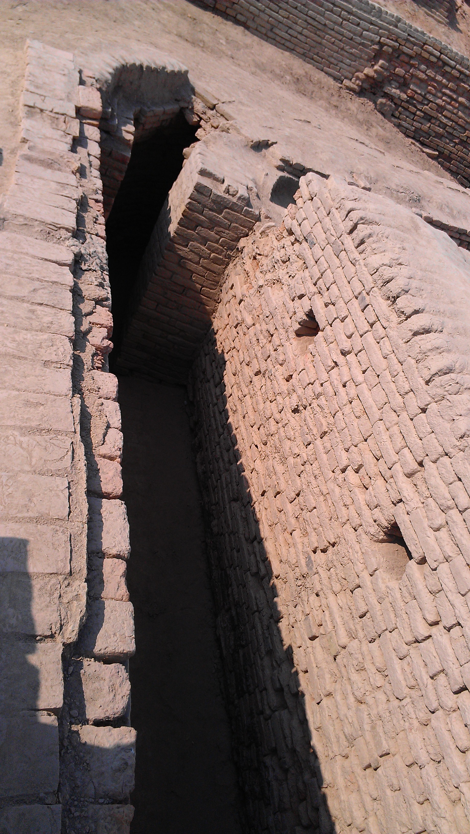
Strip away the headlines claiming to locate the world’s oldest city, and the real business of archaeology returns to its basic elements: section walls, soil color changes, and charcoal flecks recovered from undisturbed contexts. At Rakhigarhi in Haryana's Hisar district, the sprawling mound complex spanning over 300 hectares has long invited sweeping generalizations about the speed of Bronze Age urbanization. But digging deeper into the lower occupational deposits—specifically at mounds RGR-1, RGR-2, and RGR-6—presents a far more deliberate stratigraphic record.
For decades, standard models based on early excavations by Amarendra Nath for the Archaeological Survey of India (ASI) grouped the lower horizons of the Ghaggar-Hakra basin into broad cultural brackets: a Pre-Formative Sothi-Siswal horizon giving way rapidly to an Early Harappan phase, which then supposedly transformed overnight into the grand, standardized grid of the Mature Harappan urban system around 2600 BCE.
Recent radiocarbon re-examinations and micro-stratigraphic field assessments are dismantling that neat, abrupt sequence. By prioritizing short-lived organic samples—such as carbonized barley seeds and small charcoal fragments trapped inside sealed, unburnt clay hearths—archaeologists are establishing a tighter timeline for when standardized mud-brick architecture, defensive perimeter walls, and organized craft quarters actually took shape.
Reading the Section Walls at RGR-6 and RGR-1
In field archaeology, context is everything. A single piece of charcoal washed down an erosion gully or dragged into an ancient pit by burrowing animals can skew a radiocarbon date by centuries. Early radiocarbon dating campaigns in the late twentieth century often suffered from bulk sampling across deep, mixed occupational debris.
When researchers re-evaluated charcoal samples from lower levels using Accelerator Mass Spectrometry (AMS)—a technique that measures individual carbon isotopes in milligram-sized samples—the resulting dates required a critical second look. Radiocarbon analysis conducted at the Inter University Accelerator Centre (IUAC) in New Delhi on charcoal samples from depths between 9 and 23 meters across the site demonstrated how occupational horizons build up unevenly across separate mounds.
At mound RGR-6, the lowermost occupational layers yield two distinct horizons dated to roughly 5,640 and 5,440 years before present (BP) in uncalibrated radiocarbon terms, placing the earliest Sothi-Siswal settlement layers deep into the fourth millennium BCE (Wikipedia). What matters to field excavators, however, is not just the age of the charcoal, but what sits directly on top of it.
Rather than a sharp break or a sterile flood layer separating these early pit-dwelling and hearth levels from the overlying structural phases, the section walls show a continuous sequence. Domestic hearths containing carbonized cereal grains sit directly beneath the earliest mud-brick footings. The mud bricks in these transition layers do not yet follow the rigid 1:2:4 standard ratio (typically 7 × 14 × 28 cm) that defines Mature Harappan architecture across the Indus system. Instead, excavators uncovered irregular, hand-molded mud bricks laid in erratic courses using local alluvial clay mixed with paddy husk temper.
Fortifications and the Pace of Early Urban Planning
⚖ Scholarly debate: Archeologists remain divided over whether early defensive mud-brick walls across the Indus basin functioned primarily as military fortifications against rival settlements or as civil engineering barriers to protect low-lying residential quarters from seasonal monsoon floods.
At Rakhigarhi's RGR-1 and RGR-2 mounds, Early Harappan levels dating between 5,200 and 4,570 years BP reveal massive mud-brick structures (Wikipedia). These include perimeter walls and substantial raised platforms. In reports published in journals like Puratattva and Man and Environment, field directors noted that these early mud-brick walls were not constructed in a single, grand civic push.
Instead, micro-stratigraphy demonstrates multiple repair phases. A wall built from sun-dried mud bricks would wash down during heavy rains, creating a layer of melt clay. Early inhabitants did not clear this slurry away; they leveled it, compacted it with ash from nearby kilns, and laid a new wall directly on top.
This continuous rebuilding cycle shows that elements of urban organization—such as defining settlement boundaries and organizing spatial zones for specialized crafts like terracotta bangle firing and bead knapping—emerged locally over several centuries during the early third millennium BCE. The transition was not imported wholesale from mature sites further west along the Indus mainstem, such as Kot Diji or Amri, nor did it appear instantly as a response to sudden trade expansion.
The Pitfalls of "Oldest Ever" Claims
In archaeological reporting, headline-grabbing assertions that a single site represents the "oldest city in South Asia" usually collapse under rigorous chronological scrutiny. Regional site comparisons in journals like Antiquity demonstrate that early urban traits appeared non-synchronously across different river valleys.
While early farming communities at Mehrgarh in Baluchistan date back much further, the specific combination of standardized mud-brick construction, organized street alignments, and mass craft production in the Ghaggar-Hakra plain was a protracted local process. The C-14 dates from pristine hearth contexts at Rakhigarhi do not push back urban civilization by thousands of years overnight. What they actually do is far more valuable to field archaeologists: they close the chronological gaps between early agricultural hamlets and full-scale Bronze Age cities.
Evidence shows that the mud-brick grid was not invented in a single moment of civic inspiration. Tradition holds that ancient cities were founded by grand design, but scholars debate how much of Rakhigarhi’s early layout was planned in advance versus assembled organically through generations of mud-brick maintenance. By reading the thin layers of ash, burnt clay, and seed remains preserved in lower trench sections, field researchers are finally replacing speculative timelines with a firm stratigraphy grounded in physical evidence.