The Andaman Archipelago: Colonial Cartography and Ancient DNA
We compare 18th-century European navigational charts with modern aDNA studies to contrast colonial perceptions of the Andaman Islands with the archipelago’s deep history of human isolation.

Dr. Anil Patel for SwavedaJuly 19, 2026
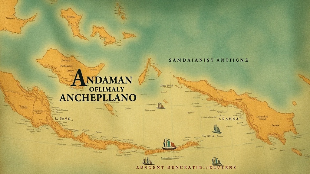
European maritime maps from the 1770s present the Andaman Islands as a series of obstacles and potential harbors along the trade route to the Bay of Bengal. A nautical chart from this period depicts the archipelago with a focus on coastal soundings and recognizable landmarks for passing ships. These documents were functional tools for the East India Company, designed to minimize the risks posed by rocky shores and unpredictable currents.
The cartographers of the 18th century viewed these islands through the lens of utility. They labeled the terrain based on what was visible from a ship’s deck: reef locations, safe anchorages, and the general outline of the coast. To these surveyors, the islands were a geographic variable in a larger colonial equation. They were places to be charted, avoided, or occasionally surveyed for strategic outposts.
The Contrast of Isolation
While 18th-century sailors were interested in the coastline, geneticists examine the interior history of these islands through a different set of records: the sequences within human DNA. Current research in ancient DNA (aDNA)—the study of genetic material recovered from archaeological remains—indicates that the indigenous Andamanese populations remained isolated from mainland demographic shifts for significant periods.
Genomic evidence, including findings published by Reich et al. (2009), confirms that the ancestors of these groups are the descendants of the initial modern human migration out of Africa. Unlike the mainland of South Asia, which experienced repeated, large-scale shifts in its genetic makeup—such as the massive movement of pastoralists from the Iranian plateau who mixed with indigenous hunter-gatherers, a process detailed by Narasimhan et al. (2019)—the Andamanese populations maintained a distinct genetic profile.
Scholars debate the exact timing of this initial arrival, but the genetic data shows a clear pattern of biological separation. While the maritime maps of the 1770s illustrate a period of increased contact between the islands and global sea lanes, the genetic evidence points to a long history of reproductive isolation that preceded these colonial charts by tens of thousands of years.
Navigational Utility vs. Genomic History
The navigational charts produced in the 18th century were concerned with the surface. They mapped the islands as static points on a grid to guide maritime traffic. If a chart noted a "well-watered bay" or a "dangerous reef," it did so to facilitate safe passage or prevent shipwrecks. There is little mention in these records of the people who resided there, except as peripheral inhabitants of a dangerous coastline.
Conversely, genomic studies treat the archipelago as a reservoir of human history. By analyzing the genomes of contemporary individuals, researchers can track the ancestry of isolated groups. This work demonstrates that the population history of the Andaman Islands is not a story of sudden arrival, but one of extended residence.
Traditional accounts often hold that these populations have lived in the region since "time immemorial," a phrase often used in oral histories to denote an indefinite, ancient past. However, evidence from aDNA provides a more specific, data-driven perspective, quantifying the duration of this isolation and distinguishing these groups from the shifting population mosaics of the Indian mainland. While the colonial mapper looked for a way to traverse the Bay of Bengal, the geneticist looks at the DNA to see how these populations remained separate from the groups currently moving through those same waters.
Bridging the Records
The disconnect between the 18th-century maritime records and the genetic findings is a matter of scale. The maps represent a transient moment in the history of global trade—a time when the East India Company sought to exert control over regional sea lanes. The aDNA data, by contrast, represent an archive of deep time.
When looking at a map from the 1770s, it is necessary to recognize it as a specific cultural artifact. It captures how colonial powers perceived their world. It does not provide insight into the deep history of the inhabitants, whose ancestors had already been present in the archipelago for millennia before the first surveyor arrived with a compass.
The study of the Andaman Islands requires this dual approach. We have the textual record of the maritime charts, which tell us about the history of colonial navigation and the risks of 18th-century travel. We also have the biological record, which tells us about human migration and the reality of deep-seated isolation. Integrating these two sources allows for a more precise understanding of the region—one that acknowledges both the temporary nature of colonial mapping and the enduring existence of populations that remained outside the trajectory of mainland demographic change.
By grounding these histories in both primary nautical records and modern genetic data, we move away from speculation. We see the islands not as a blank space on a map waiting to be filled by colonial explorers, but as a site of long-standing, distinct human presence. This perspective acknowledges the islands' importance in the history of human migration while maintaining a dry, analytical view of how those histories are interpreted by modern science and historical scholarship.