Granite Canvases: The Archaeological Record of Hyderabad’s Rock Shelters
Beyond the art, Hyderabad’s granite shelters offer critical data on the stone-tool technology and seasonal mobility of early Deccan hunter-gatherer populations.

Asha Naidu for SwavedaJuly 20, 2026
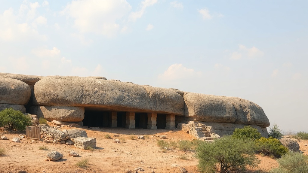
The granite formations surrounding Hyderabad—often viewed as mere urban obstacles or aesthetic backdrops—are remnants of an ancient geological history. These weathered boulders form natural cavities that served as shelters for human populations long before the city’s contemporary expansion. While recent public attention has focused on the vivid pigments left behind on these stone surfaces, archaeology views these sites as critical spatial records of mobile, hunter-gatherer communities.
Understanding Lithic Assemblages
Archaeologists do not define these sites by their art alone. Instead, they rely on lithic (stone) assemblages—the collection of tools and discarded flakes found in and around the shelters—to interpret human activity.
In the study of South Asian prehistory, these tools often provide the primary chronological markers. A study documented in the Journal of Archaeological Science regarding the broader context of the Deccan highlights how such toolkits changed over time. When researchers find micro-blades or scrapers in association with rock shelters, they look for technological patterns that signify specific periods. These tools allow scholars to debate the transition between the Mesolithic (the Middle Stone Age, characterized by the development of small, sophisticated stone tools called microliths) and subsequent periods of human settlement. Tradition holds that these shelters were occupied intermittently, a pattern consistent with the seasonal mobility required by hunter-gatherer groups navigating the plateau’s climate.
Dating the Deccan
Determining the exact age of these sites remains a complex challenge. While some earlier interpretations suggested broad timelines for Deccan rock art, scholars now exercise significant caution when assigning specific dates to these pigments. The Archaeological Survey of India (ASI) has long noted that the transition from the Paleolithic to the Mesolithic in the Deccan is best understood through the systematic analysis of stratigraphic sequences rather than isolated stylistic guesses.
Radiocarbon dating organic pigments is rarely straightforward. If the paint contains vegetable or animal binders, it can be tested, but the risk of contamination in open-air shelters is high. Therefore, archaeologists often rely on “stratigraphy”—the study of the layers of earth and debris deposited on the shelter floor. By analyzing the vertical sequence of tools and charcoal found beneath the surface, researchers can establish a relative chronology. Evidence shows that where deep deposits exist, they act as a "time capsule," preserving environmental data alongside human artifacts. As Dr. K. Paddayya has noted in his work on the Hunsgi and Baichbal Valleys, the meticulous mapping of lithic scatters in the Deccan is essential to understanding how these populations adapted to varying ecological niches.
The Geography of Granite
The term "Deccan" is derived from the Sanskrit dakshina (meaning "south"). Geologically, this region is dominated by Archaean granite—some of the oldest crustal material on Earth. These massive boulders, shaped by millions of years of weathering, created a unique micro-environment.
For early human groups, these shelters provided more than physical protection. They served as landmarks in a vast, arid landscape. The orientation of the rock cavities often corresponds with seasonal winds and water sources. Archaeology confirms that human occupation was dictated by access to ephemeral streams and pools that gathered in the crevices of the rock formations during the monsoon.
Interpreting the Art
The rock paintings themselves—typically rendered in ochre (a natural earth pigment containing iron oxide)—represent a symbolic language that remains largely enigmatic. Scholars debate whether these depictions of animals, humans, and geometric patterns were strictly decorative, ritualistic, or a method of mapping territorial boundaries.
Because many of these sites remain unexcavated, much of their archaeological potential lies undisturbed. The challenge for contemporary researchers is to reconcile the desire to protect these sites from urban encroachment with the need for formal, systematic documentation. When a site is disturbed by construction or unauthorized clearing, the archaeological context—the specific location of a stone tool in relation to a hearth or a painting—is lost forever.
Moving Toward Preservation
The study of these shelters has shifted from mere cataloging to a broader understanding of land use. Researchers now examine the "catchment area," or the distance hunter-gatherers would travel from their shelter to collect resources like wild grains, tubers, and game.
This analytical shift underscores the importance of treating Hyderabad’s granite landscape not as a blank space, but as a densely layered historical record. The stones themselves, formed billions of years ago, offer a perspective on human adaptability. While the exact duration of occupancy at any single site may be subject to future refinement through peer-reviewed excavation, the existing record confirms that these shelters were central to the lives of populations long before the historical period. As work continues, the focus remains on rigorous documentation to ensure that these fragments of history are not misinterpreted or reduced to myth.