General Zorawar Singh's Conquests: Cartography and Contested Borders
Historical maps of General Zorawar Singh's campaigns in Tibet, Gilgit, and Baltistan offer insights into past territorial understanding, influencing modern geopolitical discussions.

Vikram Joshi for SwavedaJune 18, 2026
The cartographic record surrounding the 19th-century military campaigns of General Zorawar Singh presents a complex and often contradictory picture. His expeditions, which extended Dogra rule into areas of Tibet, Gilgit, and Baltistan, are a subject of historical inquiry, particularly when juxtaposed with modern territorial claims in regions like Aksai Chin and the territories referred to by Pakistan as Pakistan-occupied Jammu and Kashmir (POJK). A critical examination of the maps from this era reveals not definitive boundaries, but rather fluid understandings of territory, influenced by the cartographic conventions of the time and the political ambitions of the period.
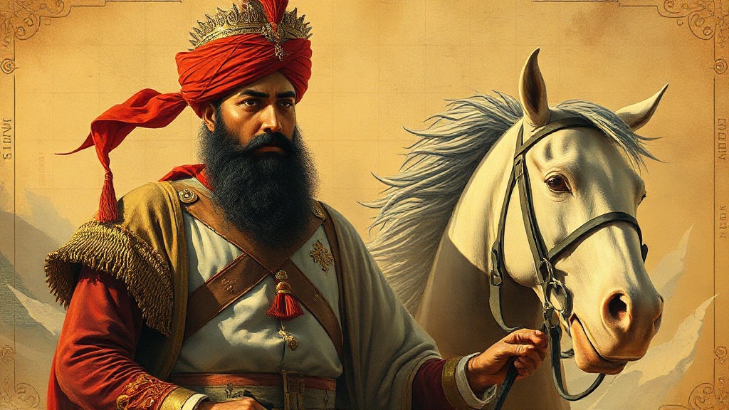
General Zorawar Singh, a commander under Maharaja Gulab Singh of Jammu and Kashmir, was instrumental in expanding Dogra influence in the mid-19th century. His military successes led to the incorporation of regions previously beyond direct Dogra control. These conquests are documented through various historical accounts and, crucially, through maps produced during or shortly after his campaigns. However, the interpretation of these maps is fraught with challenges. Early 19th-century cartography, especially in frontier regions, was often less about precise demarcation and more about indicating spheres of influence, areas of known habitation, or regions accessible to military campaigns.
One of the primary sources of cartographic information pertaining to Zorawar Singh's era is often derived from British colonial surveys, as well as local and regional sources. These maps vary significantly in their detail and accuracy. For instance, maps produced by the Survey of India, while increasingly precise over time, reflect the evolving understanding of terrain and political control as perceived by the British administration. Local maps, where they exist, may offer different perspectives, focusing on trade routes, administrative centers, or traditional territories rather than strictly defined political borders.
The region of Aksai Chin, currently a point of contention between India and China, features in discussions concerning Zorawar Singh's campaigns. Historical accounts suggest that Dogra forces reached areas that would later be considered part of Aksai Chin. However, maps from the period do not depict Aksai Chin as a clearly defined, policed border region in the way it is understood today. Instead, they often show vast, sparsely populated plateaus. The concept of a fixed border here was likely less developed in the mid-19th century than it became in the early 20th century, influenced by surveys and agreements among major powers.
Similarly, the regions of Gilgit and Baltistan, now part of Pakistan and referred to by Islamabad as POJK, were areas where Zorawar Singh’s forces exerted significant influence. Maps from this period might show Dogra control extending to these areas, but the nature of this control and its precise territorial extent can be ambiguous. Traditional understandings of governance in these mountainous regions often involved a complex web of local allegiances and tribute, rather than a rigid, demarcated frontier. Cartographic representations of these areas often reflected this complexity, sometimes showing overarching political affiliations without detailing exact boundaries.
The cartographic conventions of the 19th century play a crucial role in understanding these historical maps. Many maps were not intended to be legal boundary documents but rather to illustrate geopolitical relationships, trade networks, or areas of military strategic interest. This means that lines on a map might represent an accepted sphere of influence, a military advance, or a region of known geographical features, rather than a precisely surveyed international border. The absence of detailed surveying equipment and the challenging mountainous terrain of the Himalayas further limited the accuracy of maps produced during Zorawar Singh's time.
Furthermore, the period was marked by significant geopolitical shifts. The decline of some empires and the rise of others, coupled with the increasing influence of colonial powers like Great Britain, meant that territorial understandings were fluid. Maps were often produced or updated to reflect these changing power dynamics. For instance, British cartographers aimed to map the periphery of their sphere of influence, which included the princely states like Jammu and Kashmir, and their interactions with neighboring territories like Tibet and China.
Scholarly interpretations of the maps related to Zorawar Singh's conquests emphasize caution in drawing direct parallels to modern international borders. Historians and geographers analyzing these maps often point to the qualitative nature of the cartography. Instead of precise lines, they might find shaded areas indicating control, dotted lines representing disputed or poorly understood territories, or simply labels denoting regions rather than exact boundaries. The terminology used on these maps, such as "extent of territory" or "region under influence," further suggests a less defined concept of borders.
The Legacy of these maps is therefore not one of definitive territorial claims, but of historical understanding. They provide evidence of the reach and ambition of the Dogra state under Zorawar Singh and the geopolitical landscape of the 19th-century Himalayas. However, they do not offer a simple, unambiguous record that can be directly translated into contemporary border disputes. The application of modern notions of fixed, surveyed borders to historical cartography that predates such conventions risks anachronism and misinterpretation. The historical scholarship surrounding General Zorawar Singh's campaigns continues to highlight the importance of contextualizing cartographic evidence within the specific historical and methodological frameworks of its creation. This careful approach is essential for a nuanced understanding of the past and its relevance to present-day geopolitical discussions, grounding analysis in verifiable historical inquiry rather than assertion.