The Thar Gap: How Ratadiya Ri Dheri Rewrites the Western Harappan Map—And What Its Kilns Tell Us About Regional Networks
A newly discovered Harappan settlement in Rajasthan's Thar Desert bridges a long archaeological void, but kiln evidence suggests the "Indus culture" was messier and more regional than once thought.
Rohan Bhattacharya for SwavedaMay 10, 2026
The Thar Gap: How Ratadiya Ri Dheri Rewrites the Western Harappan Map—And What Its Kilns Tell Us About Regional Networks
When archaeologists talk about the Indus Valley Civilization, they tend to describe a web of connected urban centers—Harappa, Mohenjo-daro, Dholavira—linked by trade and a shared material culture. But between the developed sites of northern Rajasthan and the Gujarat coast has always sat an uncomfortable blank space on the map: the Thar Desert. Not empty of people, necessarily. Just empty of confirmed evidence.
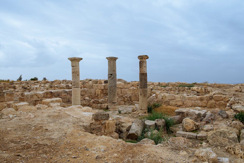
Until July 2025, no Indus Valley settlement had been confirmed in Rajasthan's Thar desert region. That silence ended when a team including Dilip Kumar Saini from Rajasthan University, Professor Jeevan Singh Kharkwal of Rajasthan Vidyapeeth, and historian Parth Jagani announced the discovery of Ratadiya Ri Dheri, a Mature Harappan phase site. The site lies 60 km from Ramgarh tehsil and 17 km from Pakistan's Sadewala, just four kilometers from the India-Pakistan border in Jaisalmer district.
This is not a headline-grabbing "oldest settlement ever" claim. It is, instead, something more useful: a rural settlement that forces us to think differently about how the Harappan world actually worked.
The Gap That Matters
Archaeologists working on the Indus system have long known that Harappan occupation in northwestern India wasn't confined to large tells (mounds) or immediate river valleys. Survey work across Gujarat and Rajasthan has turned up dozens of smaller satellite sites. But the Thar itself—particularly the western Thar, near the Pakistani border—had remained archaeologically dark. Partly this is geography: the desert is genuinely hostile. Partly, it is historical accident.
The region's archaeological survey history paused after Partition in 1947, when the newly divided border disrupted fieldwork that had crossed what became international boundaries. Earlier explorers like Sir Aurel Stein had worked the broader Great Indian Desert region, but systematic Harappan survey in the western Thar specifically did not resume at significant scale until recent years. What Ratadiya Ri Dheri does is plug a gap not of absence, but of invisibility.
The site itself is small and rural. According to Dr Jeevan Singh Kharkwal, "This is a small but significant rural Harappan site, likely dating between 2600 and 1900 BCE. Its location and characteristics bridge an important archaeological gap between northern Rajasthan and Gujarat." That modesty should be respected. This is not a rival to Kalibangan or Pilibhanga. It is a window into how the Harappan world extended into marginal terrain.
Reading the Surface
The site covers about one and a half acres. Brick fragments and intact bricks are scattered on the surface. No structural remains were encountered during the initial exploration. What the team recovered, however, is diagnostically Harappan: red ware pottery, perforated jars, terracotta cakes, chert blades, and clay and shell bangles. The chert is particularly telling—it was brought from Rohri hills in Sindh, in present-day Pakistan. This points to maintained supply chains, not isolation.
The bricks themselves offer stratigraphic clues. A rectangular brick measured at the mound had a ratio of 4:2:1, measuring 28 cm × 14 cm × 7 cm. Such dimensional standardization is a hallmark of the developed Harappan system and confirms Mature phase occupation, rather than earlier or later settlement. The presence of wedge-shaped bricks, which were generally used in well construction by Harappan-period peoples, suggests water management infrastructure—a sensible priority in desert settlement.
The Kiln Question: Evidence and Limits
Now we arrive at the crux, and where careful language becomes necessary. The site is being described as having "circular kilns with central columns similar to designs at Kanmer (Gujarat) and Mohenjo-daro (Pakistan)." A kiln with a central column and foundations consistent with Harappan architectural patterns was unearthed. This is evidence of kiln use. But the claim of "regional variation" or "network dynamics visible in kiln design" requires caution.
The sources available do not provide detailed architectural drawings, internal stratigraphy (silt layers, ash deposits, firing patterns), or comparative metrics on central-column diameter, wall thickness, or fuel-access design. A kiln with a central column can appear across vast geographical and temporal ranges. What matters for understanding networks is: What was being fired? In what quantities? With what fuel? In what architectural tradition?
Scholars remain divided on kiln organization across the Harappan world. In a 2018 overview published in Puratattva, Shinde and colleagues noted that kilns in different regions may represent distinct local ceramic traditions, standardized templates from a central authority, or simply practical responses to local clay and fuel availability. Without publication of the Ratadiya Ri Dheri kiln data in peer-reviewed outlets—a formal paper has reportedly been submitted but remains under review—we are working from announcement abstracts. That is honest information. But it is not the same as stratigraphy.
The Messier Picture
What Ratadiya Ri Dheri suggests is something long suspected by scholars of the late Harappan world: that the Indus civilization was less a monolithic bureaucratic machine and more a regional patchwork of overlapping trade and craft traditions. The site is identified as a rural Harappan settlement, part of the broader Sindh Harappan cultural and trade network. Located in the arid Thar, it indicates that Indus Valley peoples adapted to diverse ecological settings, including extremely dry environments.
Copper fragments scattered across the mound hint at craft activity—broken pieces of copper implements, a broken copper chisel, fragments of copper sheet. But surface scatter is not the same as in-situ workshop debris. Real understanding requires excavation, flotation (sifting for tiny organic remains), and geoarchaeological sampling.
What Comes Next
A detailed research paper by Dr Kharkwal and Jagani has been submitted to an international peer-reviewed journal. If accepted, the site may gain recognition as important to Harappan studies. That pathway—peer review, publication, citation and critique by other archaeologists—is where genuine knowledge emerges. Until then, Ratadiya Ri Dheri is a promising surface site with Mature Harappan diagnostics and a strategically important location.
It fills the gap. It suggests the Harappan world was bigger, more flexible, and less obviously centralized than older models proposed. And it confirms what good field archaeology does best: it makes the map smaller, and the picture messier, and thus more true to how human societies actually work.
The sands of the Thar still have more to tell. But they tell it slowly, and only if we listen without rushing to headlines.